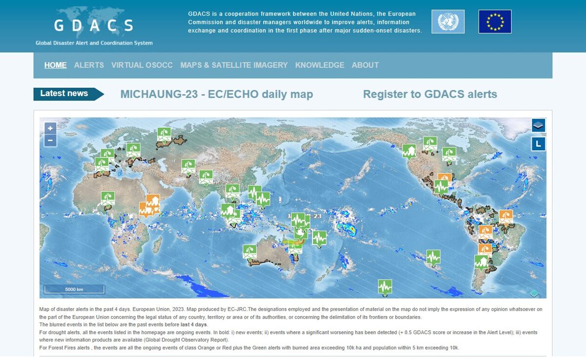
The Global Disaster Alert and Coordination System (GDACS) is a cooperation framework between the United Nations and the European Commission. It includes disaster managers and disaster information systems worldwide and aims at filling the information and coordination gaps in the first phase after major disasters.
GDACS provides real time access to web‐based disaster information systems and related coordination tools.
A more detailed description of purpose, content and guidelines, agreed and approved by the steering committee can be found here.
The activities that are presented and endorsed by the Advisory Board, which is currently chaired by the Joint Research Centre. Annual the Advisory Group meetings are attended by disaster managers, scientists, map experts, webmasters and other professionals, to define standards for information exchange and a strategy for further development of related tools and services.
What is the services of GDACS?
1. The GDACS Alert are used to issued and disseminated to some station immediately following all the disasters. The automatic estimates and risk analysis that basics of the alerts that are provided.
2. The Virtual Update is a restricted online platform for real time information exchange and co
operation among all actors in the first phase of the disaster. Information updates from the affected country and international responders are moderated by a dedicated team. The Virtual registered users that managed by the National Oceanic and Atmospheric Administration (NOAA).
3. The Maps and Satellite is a various providers that shared on the virtual trough the Satellite Mapping and Coordination System (SMCS). It provides a communication and coordination platform where organizations may monitor and inform stakeholders of their completed, current and future mapping activities during emergencies.
Who uses the GDACS?
Many governments and disaster response organizations rely on alerts and automatic impact estimations to plan international assistance and have subscribed to the virtual to use the tool for information exchange and coordination in the first disaster phase. Many governments and organizations have formulated the use of tools and services in their national disaster response plans, in particular its automatic alerts and impact estimations and the Virtual. The information is openly accessible through the GDACS platform interfaces. Data and estimated impact can be directly integrated into other web portals or websites through RSS feeds or other standard formats.
Why is the GDACS Important?
The first days after major on disasters that affected country and a vast number of international actors collect and analyst information in order to plan their response and this activity is typically carried out simultaneously with varying speed, relevance and accuracy, using multiple information channels and applying different procedures.
During the initial planning phase, there is usually a information exchange between international responders. Decisions are often based on patchy information, inaccurate sources or assumptions. The planned of system is assistance of the other rarely drawn into consideration. This often results in duplication, gaps, overlap or even inappropriate response, occasionally associated with high cost.
The services aim at facilitating information exchange among all actors in support of decision making and coordination. The services build on the collective knowledge of disaster managers worldwide and the joint capacity of all relevant disaster updates.